Where Is Pompeii Italy Located On Map: Exact GPS Location & Directions
Where Is Pompeii Italy Located On Map: Exact GPS Location & Directions. Discover practical tips for your visit. visitor guide, tickets, history of Pompeii
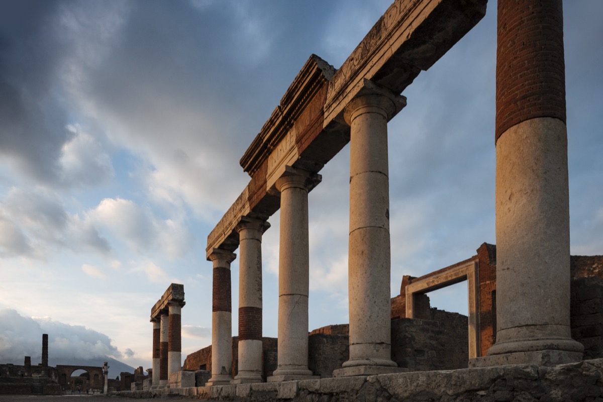
Pinpoint Pompeii's exact location in southern Italy with GPS coordinates, regional context, and distances from major cities. This guide provides everything you need to find and reach this ancient archaeological wonder.
Exact GPS coordinates and location
Primary coordinates (Archaeological Park main entrance)
- Latitude: 40.7510° N (40°45'03.60" N)
- Longitude: 14.4892° E (14°29'13.20" E)
- Elevation: 30 meters above sea level
Alternative entrance coordinates
- Porta Marina: 40.7488° N, 14.4847° E
- Piazza Anfiteatro: 40.7534° N, 14.4936° E
- Piazza Esedra: 40.7495° N, 14.4869° E
Google Maps link: View Pompeii Archaeological Park
Regional location in Italy
Administrative divisions
- Country: Italy (Repubblica Italiana)
- Region: Campania
- Province: Metropolitan City of Naples (Città Metropolitana di Napoli)
- Municipality: Pompei (modern town)
- Postal code: 80045
Geographic context
Pompeii sits in the Campania region of southern Italy, positioned:
- At the southeastern base of Mount Vesuvius
- On the Sarno River plain
- 8 km (5 miles) inland from the Bay of Naples
- Within the fertile volcanic soil region known as Campania Felix
Distance from major cities
From Naples (closest major city)
- Distance: 24 km (15 miles) southeast
- Driving time: 30-40 minutes via A3 highway
- Train time: 35-40 minutes on Circumvesuviana line
- Direct route: A3/E45 highway, exit "Pompei Ovest"
From Rome (capital)
- Distance: 242 km (150 miles) south
- Driving time: 2.5-3 hours via A1 and A3
- Train time: 2-3 hours (high-speed to Naples + local train)
- Route: A1 to Naples, then A3 to Pompei
From Sorrento
- Distance: 27 km (17 miles) northwest
- Driving time: 45 minutes via SS145
- Train time: 30-35 minutes on Circumvesuviana
- Scenic route: Coastal road through Piano di Sorrento
From Amalfi
- Distance: 50 km (31 miles) northwest
- Driving time: 1.5 hours via SS163 and A3
- Bus + train: 2-2.5 hours with connection in Sorrento
- Route: Coastal road to Sorrento, then SS145
From Salerno
- Distance: 30 km (19 miles) north
- Driving time: 30 minutes via A3
- Train time: 40-50 minutes with connection
- Direct route: A3 highway northbound
Surrounding landmarks and towns
Immediate vicinity (within 10 km)
- Mount Vesuvius crater: 10 km northeast
- Herculaneum: 16 km northwest
- Torre Annunziata: 5 km west
- Boscoreale: 3 km north
- Scafati: 4 km east
Notable nearby sites
- Villa Oplontis: 3 km west (ancient luxury villa)
- Stabiae: 9 km southeast (ancient villas)
- Vesuvius National Park entrance: 8 km north
- Bay of Naples coastline: 8 km west
How to identify Pompeii on a map
Visual landmarks to spot
- Mount Vesuvius: Look for the distinctive volcanic cone northeast
- A3 Highway: Major north-south motorway running nearby
- Circumvesuviana railway: Local train line passing through
- Modern Pompei town: Adjacent to archaeological site
Map features
- Appears as large rectangular excavated area
- Clearly marked as "Scavi di Pompei" (Pompeii Excavations)
- Brown/archaeological site coloring on most maps
- UNESCO World Heritage Site symbol
Getting your bearings: Regional overview
Campania region highlights
The Campania region where Pompeii is located includes:
- Capital: Naples (Napoli)
- Population: 5.8 million
- Famous for: Pizza, mozzarella, archaeological sites
- Climate: Mediterranean with hot summers, mild winters
Position within Italy
- Southern Italy, western coast
- Part of the historic Kingdom of Naples
- Tyrrhenian Sea to the west
- Apennine Mountains to the east
Transportation connections
Major airports
-
Naples International Airport (NAP)
- Distance: 28 km
- Transfer time: 45-60 minutes
- Options: Bus, train, taxi, rental car
-
Rome Fiumicino (FCO)
- Distance: 260 km
- Transfer time: 3-4 hours
- Best option: Train to Naples, then local transport
Train stations
- Pompei Scavi-Villa dei Misteri: Circumvesuviana line (closest to ruins)
- Pompei: Trenitalia station (modern town center)
- Torre Annunziata: Regional trains from Rome/Salerno
Highway access
- A3/E45: Naples-Salerno motorway
- Exit: "Pompei Ovest" for archaeological park
- Toll: €1.80 from Naples
Climate and best visiting times
Seasonal overview
- Spring (Mar-May): 15-22°C, ideal weather
- Summer (Jun-Aug): 25-32°C, hot and crowded
- Autumn (Sep-Nov): 18-25°C, pleasant temperatures
- Winter (Dec-Feb): 8-15°C, fewer tourists
Weather patterns
- Mediterranean climate influenced by proximity to sea
- Mount Vesuvius creates local microclimate
- Average 250 sunny days per year
- Rainy season: November-February
Practical navigation tips
Using GPS and maps
- Search for "Pompeii Archaeological Park" not just "Pompeii"
- Modern town "Pompei" (one 'i') vs ancient "Pompeii" (two 'i's)
- Set navigation to specific entrance gates
- Download offline maps before visiting
Common navigation mistakes
- Confusing modern Pompei with archaeological site
- Going to wrong train station (Pompei vs Pompei Scavi)
- Missing highway exit (only one for archaeological park)
- Using outdated maps showing closed entrances
Historical context of location
Why this location?
- Fertile volcanic soil for agriculture
- Strategic position for trade routes
- Access to sea via Sarno River
- Protected by Mount Vesuvius (ironically)
Ancient geography
- Originally closer to coastline (now 2 km inland)
- River port for maritime trade
- Crossroads between Rome and southern Italy
- Part of ancient Campania Felix ("Happy Countryside")
Conclusion
Pompeii's location in southern Italy's Campania region makes it easily accessible from major cities like Naples and Rome. Situated at coordinates 40.7510° N, 14.4892° E, the archaeological park lies 24 km southeast of Naples at the base of Mount Vesuvius. Whether arriving by car via the A3 highway, by train on the Circumvesuviana line, or as part of a tour from nearby destinations, finding Pompeii is straightforward with proper navigation. Use these coordinates and directions to plan your journey to one of the world's most fascinating archaeological sites.